

Turnaichaidh [Creag Mhor]
Good walks are even better shared.
Overview
Turnaichaidh [Creag Mhor]
Overview
Nestled in the heart of the Scottish Highlands, Turnaichaidh, also known as Creag Mhor, stands at an elevation of 836 meters. As a Hewitt, it offers both challenge and reward to avid hikers, while its stunning vistas are a feast for the eyes and a balm for the soul.
Geology
The mountain boasts fascinating geology, primarily comprising ancient metamorphic rocks that have withstood the test of time. The rugged outcrops not only add to its charm but also tell tales of the Earth's turbulent past.
Getting There
Parking
Access starts at the Beinn Dòbhrain car park, which can fill up quickly, especially on sunny weekends. Arriving at the crack of dawn might just grant you the prime parking spot.
Public Transport
Buses from Oban to Taynuilt are your best bet if you wish to skip driving. Just be sure to consult local timetables; you don’t want to miss your bus after a long hike!
Nearest Town
Taynuilt is just a stone’s throw away and is the go-to place for refreshments and any last-minute supplies.
The Hike
Route
The route starting from Beinn Dòbhrain is a moderate hike of about 8 km, taking roughly 5 hours to conquer, depending on your pace (and the number of snack breaks you take!). The trail winds through lush glens, gradually leading you skyward, ensuring plenty of breathtaking views along the way.
Summit Features
At the summit, you’ll find a large cairn, an ideal spot to take a breather, enjoy a well-deserved snack, and snap some memorable photos. Just don’t forget to smile or you might scare away the elusive Scottish wildlife!
Views
Once you've reached the top, prepare to be amazed. The summit offers panoramic views including Loch Awe and the magnificent Argyll Alps. Best viewed in autumn or early spring when the skies are clear and the air is crisp.
Hazards
As lovely as the hike can be, it’s not without its pitfalls; be cautious of loose rocks and unpredictable weather. Always check ahead and prepare accordingly!
Nearby Summits
Make sure to also explore nearby peaks such as Beinn Bhreac for more breathtaking sights and even more fantastic hikes.
Facilities
While the hike is delightful, don't forget to stock up in Taynuilt before heading out. It’s quite a trek, and nothing worse than a grumbling tummy halfway up!
Conclusion
So there you have it: Turnaichaidh may not be the tallest mountain around, but it holds its head high with beauty and charm. Whether you're an experienced hiker or a curious novice, it offers an adventure to remember.
Happy hiking!
Explore routes near Turnaichaidh [Creag Mhor]
Public walks starting within 80 km of this hill. Nearby does not mean a route reaches the summit; check its map and access before setting out.
Portballintrae to Giant's Causeway: railway path and Blue Trail return
View route
Crinan Canal: Bellanoch and Dunardry towpath return
View route
Route planning notes
These notes describe possible approaches, not verified navigable routes or permission to cross land. Check current paths, local access rules and conditions before setting out.
Beinn Dòbhrain Start Point
A picturesque trail starting from the Beinn Dòbhrain path leads you through lush glens and gradually ascends to the summit.
Make a day of it, together
Find someone to share the walk with, or organise a day out along a route you like.
Photo Gallery
View all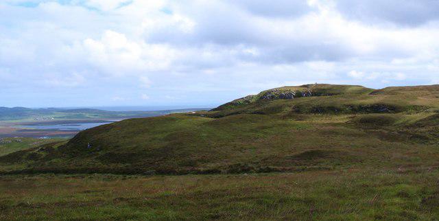 Photo could not load
NR2162 : Looking towards the trig point on Turnaichaidh
Gordon Hatton
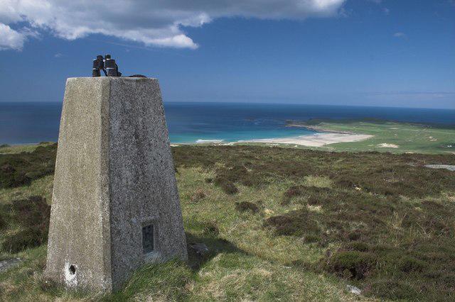 Photo could not load
NR2162 : Trig point, Turnaichaidh, Islay
Becky Williamson
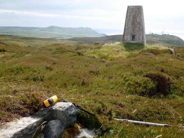 Photo could not load
NR2162 : Turnaichaidh [Creag Mhor]
Rude Health
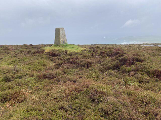 Photo could not load
NR2162 : Turnaichaidh Trig Point Flush Bracket S9071
thejackrustles
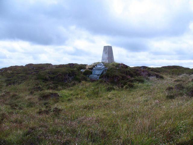 Photo could not load
NR2162 : Trig point on Turnaichaidh
Gordon Hatton
Hill facts and local notes
Classifications
Elevation
170m
558 ft
Prominence
102m
Coordinates
55.7762, -6.4351
NR219625
OS Map
60
Explorer: 353W
At the Summit
The summit is marked by a large cairn, providing a perfect spot for a well-deserved snack and photo opportunity.
Terrain & Geology
Primarily composed of ancient metamorphic rocks, this mountain exhibits classic Highland features with rugged outcrops and scree slopes.
Views & Scenery
From the summit, one can enjoy breathtaking views of the surrounding Munros and glens, including Loch Awe and the distant peaks of the Argyll Alps.
History & Heritage
Name Origin
The name 'Turnaichaidh' derives from the Gaelic, meaning 'the place of the turas,' referencing its historical significance as a wayfinding point in the rugged landscape.
Historical Significance
The area has rich cultural history, often associated with ancient paths used by locals and shepherds for centuries.
Getting There & Facilities
Check current local access restrictions, parking rules and transport timetables before travelling. These notes do not confirm public access to the summit.
Parking
Parking available at the Beinn Dòbhrain car park. Limited spaces; arrive early to secure a spot.
Public Transport
Buses run from Oban to nearby villages. Check local timetables for best connections.
Nearby Facilities
There are limited facilities in Taynuilt, such as cafes and public toilets. Bring sufficient supplies for the hike.
Safety Information
Known Hazards
- Watch out for loose rocks on the ascent and descent. Conditions can change rapidly; always check the weather before you go.
General Safety Tips
- Check weather conditions before setting out
- Carry appropriate clothing and equipment
- Let someone know your planned route
- Take a map, compass, and GPS device
- Carry emergency supplies: food, water, first aid kit, torch
Hills
Some common questions about the hills answered
Are there group walks up Turnaichaidh [Creag Mhor]?
Many walkers use Walkmates to join or organise walks with others. You can check for group walks around Turnaichaidh [Creag Mhor] through the maps
Are there other walkers around Turnaichaidh [Creag Mhor]?
Activity varies by location and time, but Walkmates lets you see whether others have shared walks or shown interest in this area. Find other people through the walking friends search walking friends for Turnaichaidh [Creag Mhor] search or of course create your own walk for Turnaichaidh [Creag Mhor]
Can I organise a walk to Turnaichaidh [Creag Mhor]?
Yes. If there aren’t any walks listed already, you can create a walk and make it available for others to join.
If you're signed up to Walkmates, you can create a walk to Turnaichaidh [Creag Mhor].
How do I find a walk up this hill?
There are often multiple ways to walk this hill, depending on experience and route preference. Walkmates helps you explore walks and routes that others have shared.
Can I suggest a new route up Turnaichaidh [Creag Mhor]?
Yes. You can suggest or create routes to share with others. Walkmates focuses on the social side of walking, so routes are used to help people organise walks and explore areas together, rather than as detailed navigation tools or route libraries.
Other uses really appreciate knowledgeable walkers sharing their routes. Share your favourite route to Turnaichaidh [Creag Mhor] here
The is an error or something incorrect about this hill. How do I let you know?
We always strive to keep the information on Walkmates as accurate as possible. If you find an error, please let us know through the contact form and we'll aim to correct it as quickly as possible
Community Discussion
Comments
Location
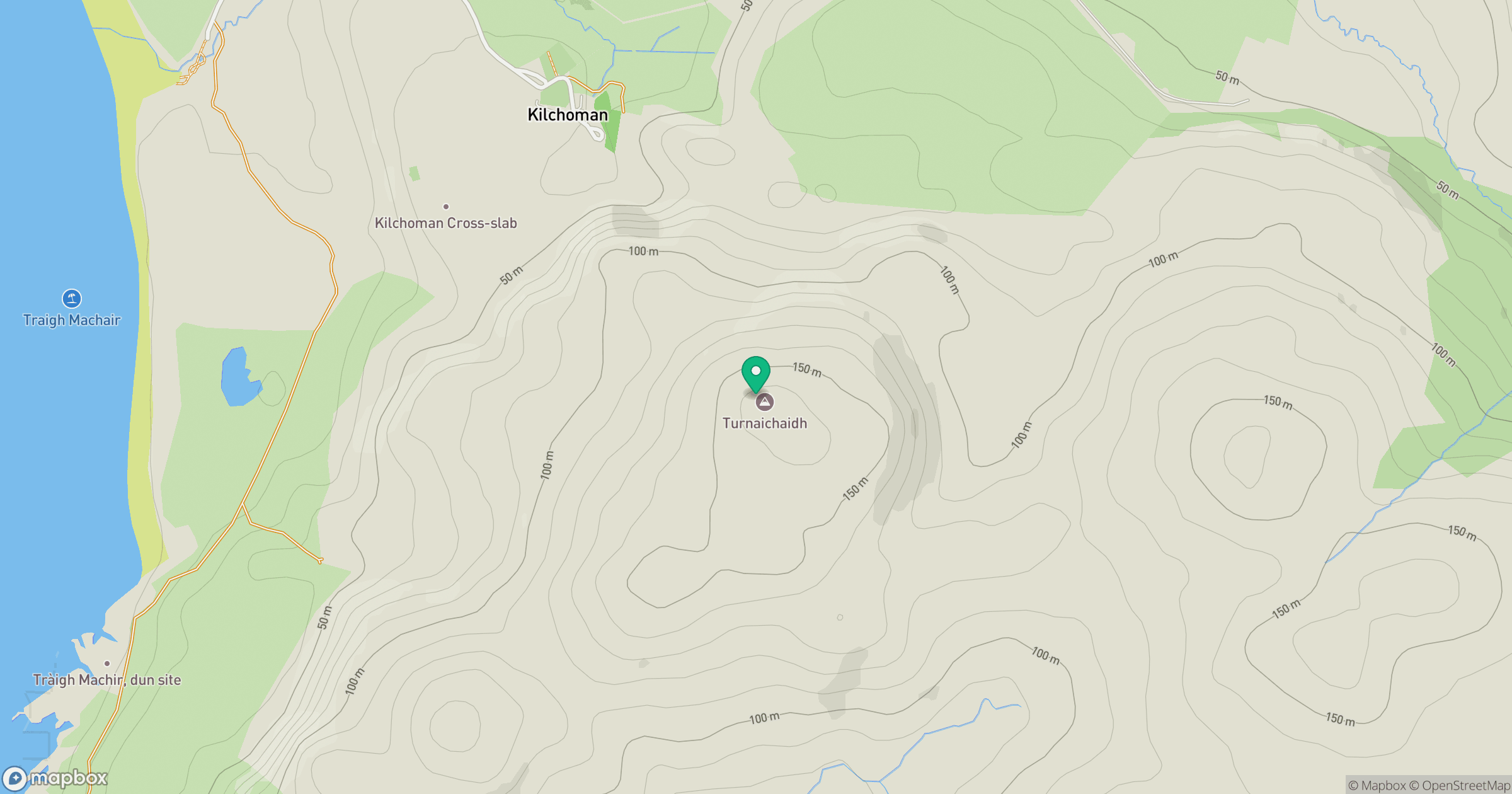
Grid reference: NR219625
View on OpenStreetMapOpens a map in a new tab, centred on the hill.
Hills within 30 km
Straight-line distance, not a walking route or confirmation of access.
No comments yet. Be the first.